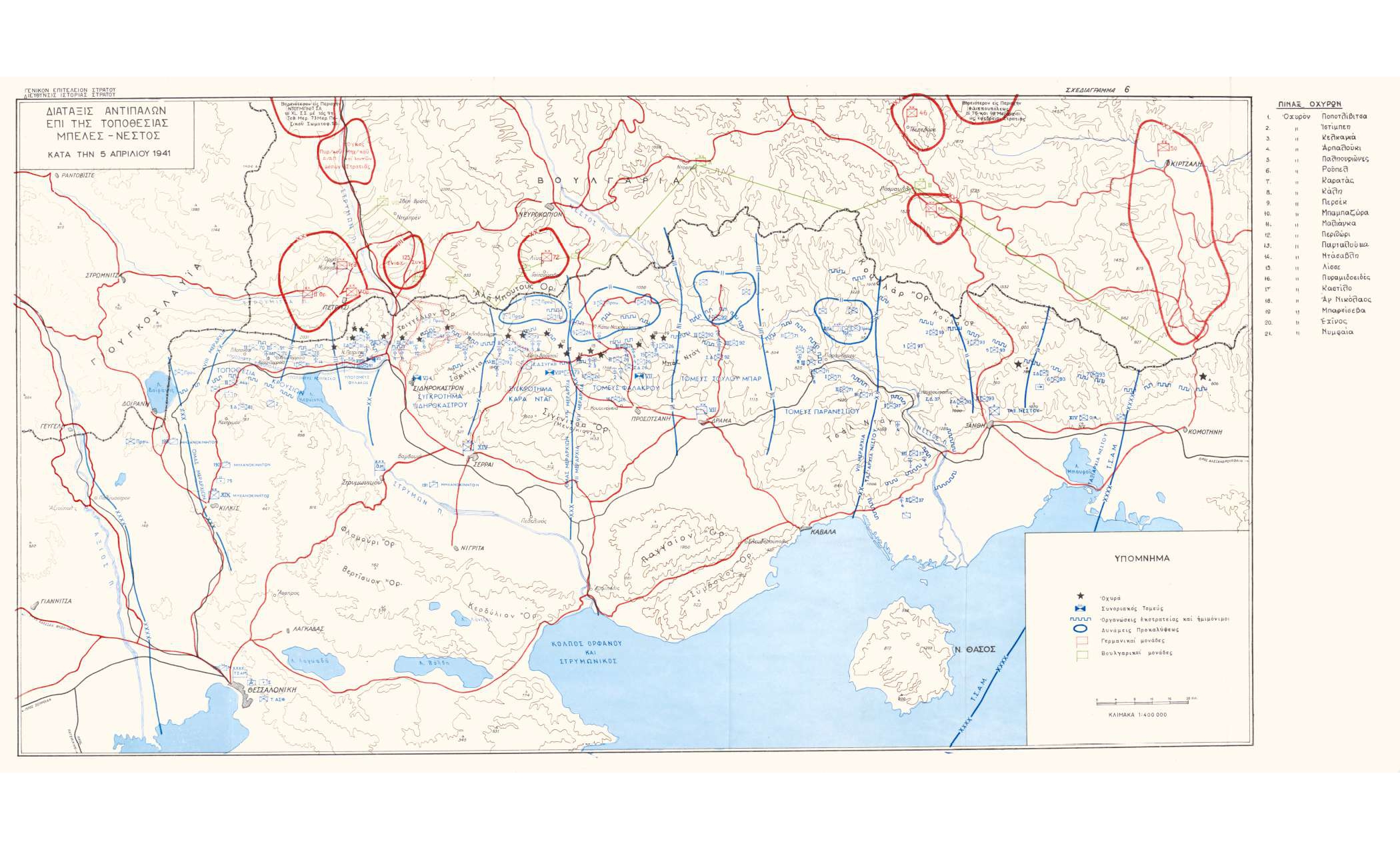
Map of the Greek forts with the positions of the opposing forces on the eve of the German invasion of Greece
Φωτ: Army History DirectorateArmy History Directorate
Map
ΜοιράσουΤίτλος
Map of the Greek forts with the positions of the opposing forces on the eve of the German invasion of Greece
Συνεισφέρων/Συντελεστής
Δημιουργός
Διεύθυνση Ιστορίας Στρατού Army History Directorate
Μορφότυπος
JPG
Γλώσσα
gre
Άδεια Χρήσης
https://creativecommons.org/licenses/by-nc/4.0/deed.el
Γεωγραφική Κάλυψη
Balkan Peninsula
Χρονική κάλυψη
World War II
Ημερομηνία Ψηφιοποίησης
Unknown
Θέμα
Map
Κάτοχος Δικαιωμάτων
The Photography Museum ''Christos Kalemkeris'' of the Municipality of Kalamaria
