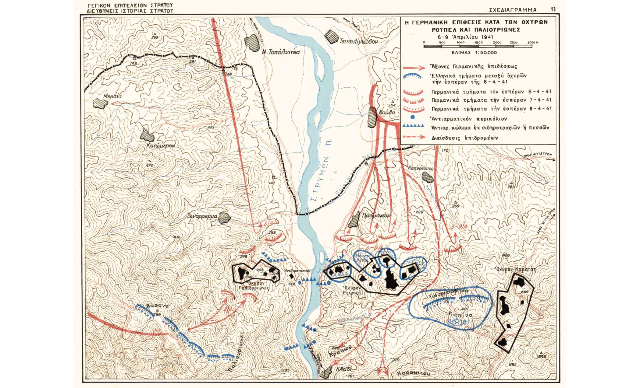
Map with the German operations against Rοupel and the other forts of the Stirigma Subsector, during the period April 6-9, 1941
Φωτ: Directorate of Army HistoryDirectorate of Army History
Fort Roupel
ΜοιράσουΤίτλος
Map with the German operations against Rοupel and the other forts of the Stirigma Subsector, during the period April 6-9, 1941
Συνεισφέρων/Συντελεστής
Δημιουργός
Διεύθυνση Ιστορίας Στρατού Directorate of Army History
Μορφότυπος
Γλώσσα
Άδεια Χρήσης
Γεωγραφική Κάλυψη
Χρονική κάλυψη
Ημερομηνία Ψηφιοποίησης
Unknown
Θέμα
Fort Roupel
Κάτοχος Δικαιωμάτων
The Photography Museum ''Christos Kalemkeris'' of the Municipality of Kalamaria
