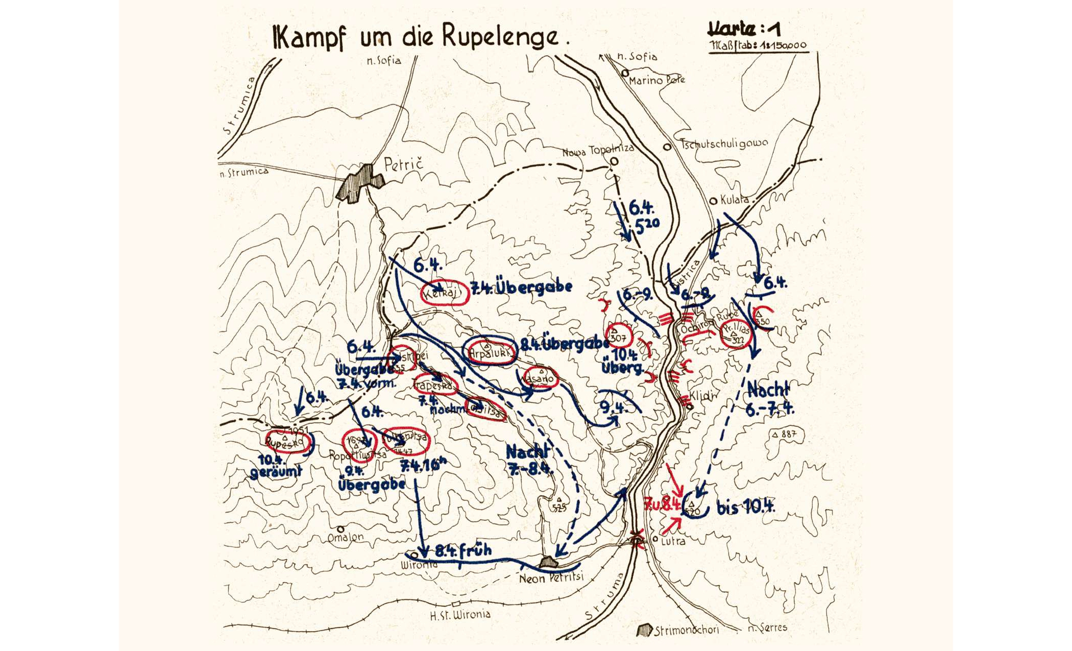
Operational map of the Germans in the Thylacos and Rοupesco subsectors of the Metaxas Line, during April 6-10, 1941
Map
ΜοιράσουΤίτλος
Operational map of the Germans in the Thylacos and Rοupesco subsectors of the Metaxas Line, during April 6-10, 1941
Συνεισφέρων/Συντελεστής
Μορφότυπος
JPG
Γλώσσα
ger
Άδεια Χρήσης
https://creativecommons.org/licenses/by-nc/4.0/deed.el
Γεωγραφική Κάλυψη
Region of Serres, Central Macedonia, Greece
Χρονική κάλυψη
World War II
Ημερομηνία Ψηφιοποίησης
Unknown
Θέμα
Map
Κάτοχος Δικαιωμάτων
The Photography Museum ''Christos Kalemkeris'' of the Municipality of Kalamaria